
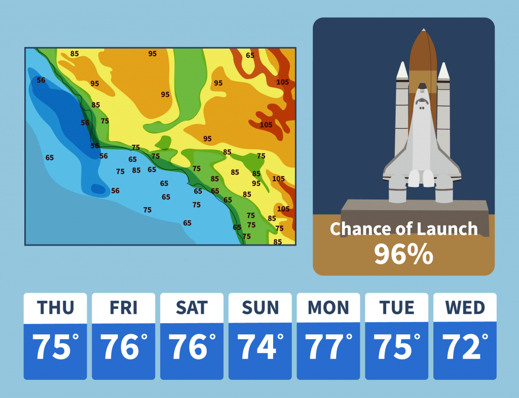
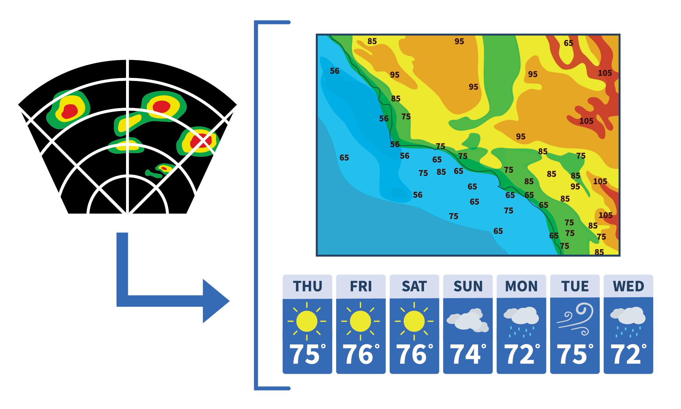
 Launching space vehicles requires intensive pre-launch analysis of weather conditions so range safety operators and space vehicle operators can make confident go-no-go launch decisions. Launch customers also use this data on the fly for adjustments to optimize launch performance as well as historic weather data for analytics and modeling. In addition, current weather observations are used for base operations to keep staff safe in the event of a chemical spill or incident influenced by weather events. VSFB currently uses a website known as the XUI (external user interface) to aggregate and display weather data to operations staff and external partners from more than a two hundred range instruments including wind anemometers, mini-SODARs (sonic/radar feeds), Doppler Radar Wind Profilers (DRWP), upper air balloon weather data, and more.
Over the past twenty years, commercial and government space launch customers have not had an easy way to access this data to assess the viability of a launch. Rather, they have had to view the XUI web application and manually capture the weather instrumentation data feeds by crawling and scraping them from the app. On top of this, the primary XUI server is routinely subject to failure requiring a backup server that is also subject to the same failure issues, making access to the data potentially unreliable during launch windows. If launch customers want access to the weather data archive, they are required to submit a request and then receive hundreds to thousands of individual files, each representing detailed historic weather data. This requires hours of manual data management and administration labor from the VSFB weather office for each request and similar manual data management and labor for the launch customer once they receive the files from the VSFB weather office.
Launching space vehicles requires intensive pre-launch analysis of weather conditions so range safety operators and space vehicle operators can make confident go-no-go launch decisions. Launch customers also use this data on the fly for adjustments to optimize launch performance as well as historic weather data for analytics and modeling. In addition, current weather observations are used for base operations to keep staff safe in the event of a chemical spill or incident influenced by weather events. VSFB currently uses a website known as the XUI (external user interface) to aggregate and display weather data to operations staff and external partners from more than a two hundred range instruments including wind anemometers, mini-SODARs (sonic/radar feeds), Doppler Radar Wind Profilers (DRWP), upper air balloon weather data, and more.
Over the past twenty years, commercial and government space launch customers have not had an easy way to access this data to assess the viability of a launch. Rather, they have had to view the XUI web application and manually capture the weather instrumentation data feeds by crawling and scraping them from the app. On top of this, the primary XUI server is routinely subject to failure requiring a backup server that is also subject to the same failure issues, making access to the data potentially unreliable during launch windows. If launch customers want access to the weather data archive, they are required to submit a request and then receive hundreds to thousands of individual files, each representing detailed historic weather data. This requires hours of manual data management and administration labor from the VSFB weather office for each request and similar manual data management and labor for the launch customer once they receive the files from the VSFB weather office. 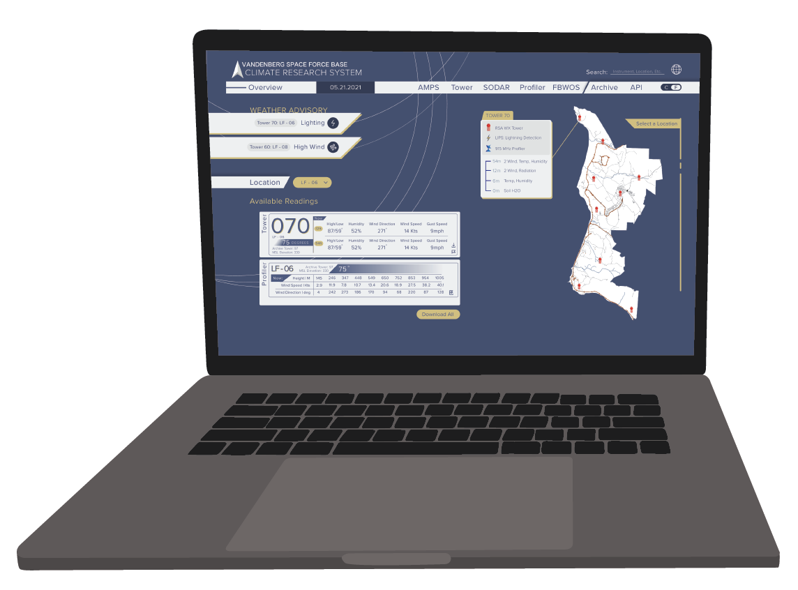 At the request of the Space Launch Delta 30 Weather Office, the DxHub interviewed existing commercial launch customers as well as weather and climate personnel at VASB. After analyzing the pain points of these stakeholders, the DxHub and range personnel chose to innovate and simplify the way that users consume range instrumentation data. The team demonstrated how the data can be hosted in the cloud and accessed via an API (application programming interface). This provides self-service access to the commercial launch community as well as other range stakeholders whom in the future may want to easy access to these data in visual formats. While this solution may seem obvious, integrating with technical systems at a legacy military facility like VASB has historically proven to be difficult. The DxHub team demonstrated that these types of solutions and data hosting can be developed and implemented rapidly and at low risk by using the AWS GovCloud.
 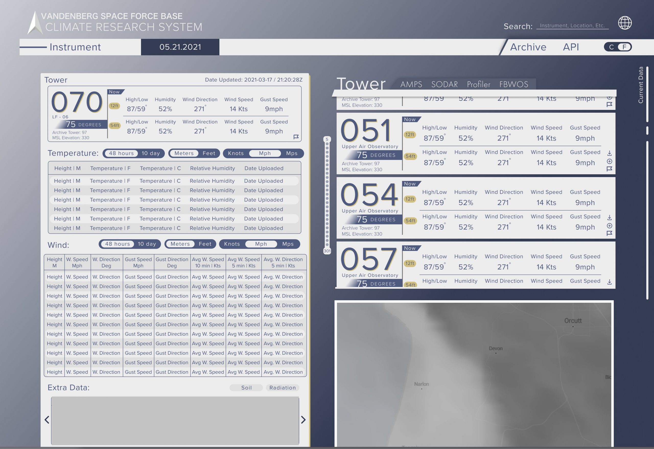 The team decided to build a flexible interface to pull in data from the multitude of weather instruments that would accommodate both modern and older instrumentation. The team used AWS Simple Storage Solution (S3)to accept any file that each instrument could potentially generate and added code using an AWS Lambda trigger to call the appropriate parser for that instrument. This abstraction allows for newer instruments to be added easily and pushes the logic for each instrument to a self-contained Lambda function. The team was given a series of historic files from each instrument, but AWS Kinesis could easily be added to push files as soon as the instrument generates them for a near real-time consumption of instrument data. The AWS Lambda functions parse each file then record the data in a structured AWS RDS Aurora instance. Central to the entire solution is a mature API that uses AWS API Gateway to pull the structured data out programmatically. This API engine was then used to build a new React website that allows users to view current observations as well as flag archive data for download. The API also provides a method for modern space customers to interact with the data programmatically to modernize how they consume and prepare data for launch vehicles.